
A deep, moisture-saturated northeast flow is driving severe weather across much of the North Island as of Tuesday 29 July, with conditions deteriorating rapidly and forecast to remain dangerous well into Wednesday. Rainfall rates of 25 to 40mm per hour are expected across multiple regions, and embedded convection within the frontal system is raising the threat of serious thunderstorms stretching from Auckland through to the Bay of Plenty.
The most intense accumulations are concentrated in two areas. The Coromandel Peninsula is forecast to collect up to 130mm before early Wednesday morning, while the Bay of Plenty, particularly the inland country near Kawerau, could see totals exceeding 180mm.
“Rainfall of this intensity can cause surface and flash flooding, especially in narrow valleys and stream catchments,” warned MetService in its latest alert.
Auckland, Northland, Coromandel and eastern Waikato all face heightened risk of slips and sudden stream surges. Strong Wind Watches are active across these regions as northeast winds push toward severe gale force in exposed locations. Hazardous driving conditions are expected to persist through Wednesday morning.
The upper and western South Island is not escaping the system's reach. Orange Warnings for heavy rain are currently in place across Westland, Tasman, Nelson, Marlborough, the Canterbury headwaters and Otago's alpine river catchments. Rainfall totals of up to 180mm are anticipated across the Taranaki Maunga, Otago Headwaters and the southern main divide, with a moderate risk of flooding and slips across those areas.
Relief is approaching from the south. A second front is due to track northward across the South Island later this week, followed by a deep low pressure system developing to the east of New Zealand. That low will drive a southerly change up the eastern North Island, bringing colder and showery air with it, while a ridge building in from the Tasman gradually shelters the South Island and stabilises conditions there.
For anyone boating or working along the coast, today's marine conditions are dangerous across large parts of the country.
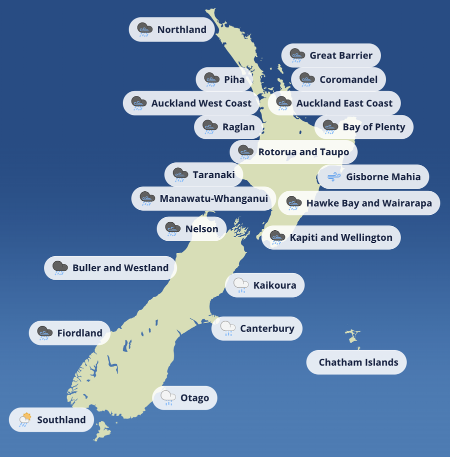
Heavy rain, strong winds and significantly reduced visibility are combining to create serious hazards in exposed harbours and nearshore zones. The areas most affected include the Auckland and Hauraki Gulf, the Bay of Plenty, the Coromandel Peninsula and Northland's east coast. In these locations, heavy onshore rain bands, embedded convective cells and elevated run-off are making river bars unpredictable and tidal inlets prone to surging. Any coastal passage in or near these zones should be avoided.
Later in the week, the focus shifts eastward. A deep low spinning up offshore will generate strong southerlies particularly east of Gisborne and the Mahia Peninsula, while southern and western waters come under the settling influence of the approaching ridge.
“Ensure anchorage is secure, check deck drainage, and avoid coastal transits during peak rainfall or wind,” advises the Boating NZ team. “This isn’t a good week for marginal decision-making.”
Looking ahead through the rest of the week, Wednesday 30 July will see rain and strong winds persist across the North Island with the thunderstorm risk easing by nightfall, while the front clears the South Island. Thursday 31 July brings a strong southerly flow to the eastern North Island, with colder and showery conditions arriving as two offshore lows dominate the weather picture. By Friday 1 August, rain is tapering over the North Island and the South Island is stabilising under an expanding ridge. Saturday 2 August is expected to bring calmer conditions across much of the country as the ridge continues to build from the Tasman.
Boaties, backcountry users and regional authorities need to remain on high alert through this period. River levels are likely to respond quickly wherever rainfall totals exceed warning thresholds, meaning even short outings require careful planning. Those living or boating in low-lying or flood-prone areas should clear drains and scuppers, check mooring lines and anchorage security, and avoid any non-essential coastal passages. Keeping a close watch on MetService and local Civil Defence updates is essential. Treat this system with the seriousness it deserves.