
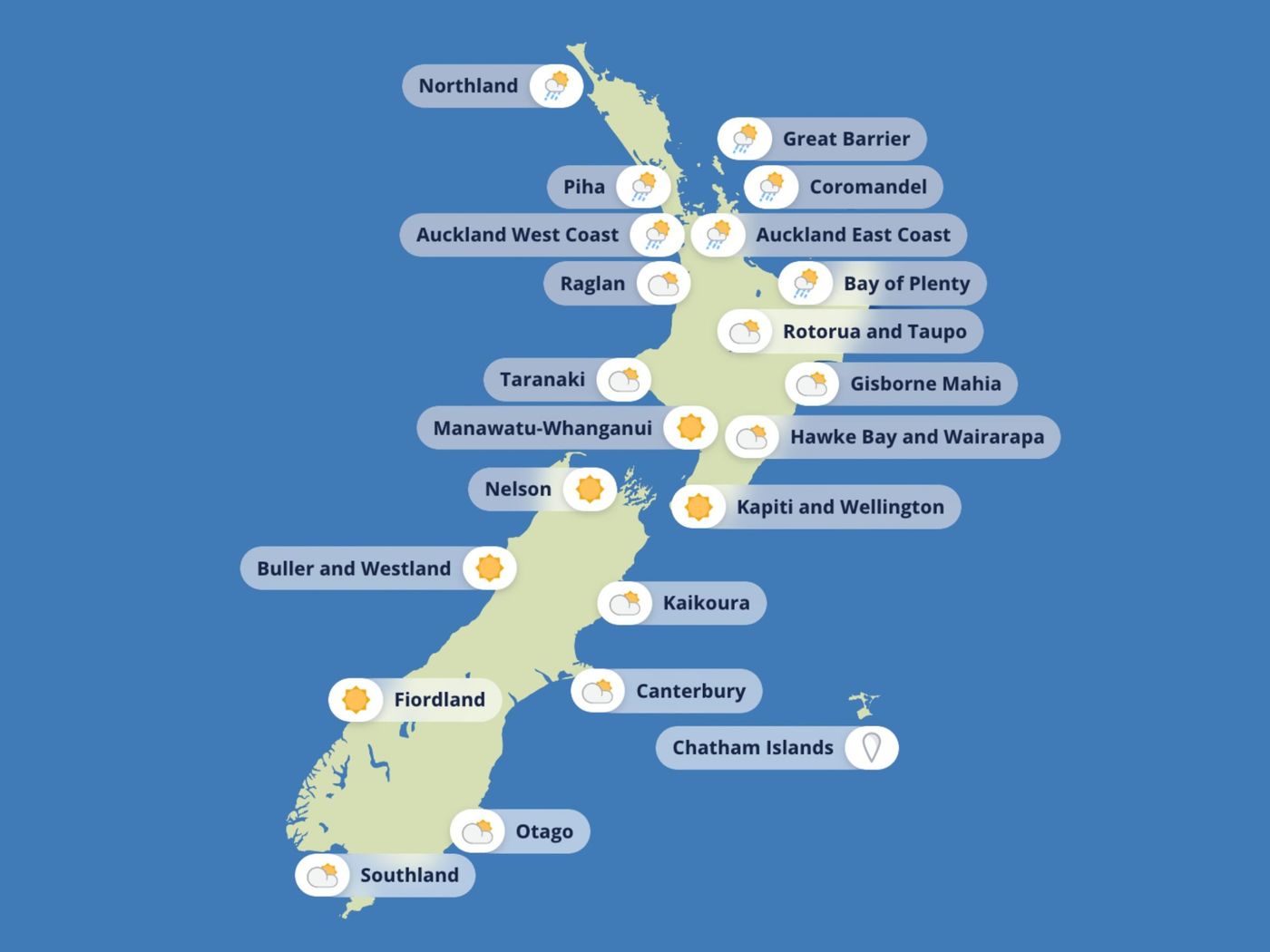
Late August delivered its characteristic split personality this week, arriving on the back of a dramatic weekend that produced more than 3,000 lightning strikes across the upper North Island and left hail scattered across Auckland's suburbs. The opening days bring a welcome contrast, with calmer seas and fine weather spreading across much of New Zealand on Monday and Tuesday. Frosty mornings inland give way to sunny afternoons, and the mood afloat is considerably more relaxed than the weekend's fireworks suggested.
Wellington, Christchurch, and Kapiti are among the beneficiaries, with smooth seas and light breezes holding through Tuesday. On the inland lakes, boaties at Lake Taupō and Rotorua can look forward to largely settled conditions, broken only by the odd shower and a light wind. Whether the plan is a fishing run, a short cruise, or some long-overdue maintenance out on the water, Monday and Tuesday offer a genuine window of opportunity across central and southern New Zealand.
The picture is considerably less appealing along the North Island's northern and eastern margins. MetService has flagged blustery easterlies and rough seas for the Bay of Islands, the Hauraki Gulf, the Coromandel, and Gisborne, and the detail behind those warnings deserves close attention.
In the Bay of Islands, winds are expected to reach 30 knots and gust to 40 by Tuesday, with seas building to between 3 and 4 metres. Thursday is the earliest realistic departure point for anyone waiting for an improvement. The Hauraki Gulf faces strong easterlies gusting to 35 knots on Tuesday, pushing up rough seas that won't settle until late Wednesday at the earliest. Colville Channel is in an even worse position, with gale-force southeasterlies arriving Tuesday evening making it a no-go zone for small craft. Along the coast in Gisborne and the wider Tairāwhiti region, persistent rain, at times heavy, combines with strong easterlies to keep conditions hazardous through Wednesday. Strong gusts, limited visibility, and heavy swells in exposed waters add up to genuine risk for anyone tempted to push their luck in these areas.
The second half of the week brings a different kind of disruption, this time from the south and west. A Tasman front pushes into Fiordland and Southland from Wednesday night, carrying strong northwesterlies and bursts of heavy rain. The system tracks northward through Thursday before eventually reaching the North Island on Friday. Fiordland and Westland face rough seas and driving rain from Wednesday night, while Cook Strait and the Wairarapa can expect winds rising on Thursday and peaking at around 25 knots from the northwest. Cold air behind the front brings the possibility of snow to alpine roads and high-country stations on Friday. Eastern regions including Hawke's Bay and Canterbury will see sunshine return by Friday, though the associated winds are enough to keep boaties cautious even there.
{{TABLE_1}}
For those trying to identify the best options this week, Wellington Harbour, Kapiti, and Mana stand out clearly, with light winds and flat water holding through Wednesday before conditions strengthen on Thursday. The Canterbury coast and Christchurch remain smooth until late Thursday, when only modest breezes are expected. The Bay of Plenty offers mostly fine weather with manageable swells, particularly across Monday and Tuesday, and the inland lakes at Taupō and Rotorua provide calm midweek windows well suited to a winter paddle or a session chasing trout.
The places to steer well clear of are equally straightforward. The Bay of Islands, Hauraki Gulf, and Coromandel carry strong wind advisories and gale warnings from Tuesday through Wednesday. Colville Channel ranks as one of the roughest spots of the week, with gusts exceeding 40 knots and very rough seas. The Gisborne and northern Hawke's Bay coastline remains off-limits through Wednesday, given the heavy rain and blustery southeasterlies. From Wednesday night, Fiordland and the West Coast join the list as heavy rain and northwesterlies make conditions unsafe.
MetService meteorologist Silvia Martino frames the week neatly: "Winter still has one last gasp for us, as chillier air sweeps back up the country on Friday."
The pattern is textbook late August: fine and settled to start, wild and blustery toward the end. The smart move is to take full advantage of the early-week calm across central and southern waters, while those in the north and east wait for Thursday's improvement. Spring is edging closer, but the sea has not quite released its grip on winter yet.