Land Information New Zealand, better known as LINZ, carries a responsibility that touches every skipper on New Zealand waters. Its hydrographic office maintains the authoritative record of our coastline, covering harbours, channels, offshore hazards, and everything in between. From a weekend run to Great Barrier Island to a fishing charter operating out of Fiordland, LINZ charts represent the legal standard for navigation in this country.
Most boaties today rely on some combination of smartphone apps and chartplotters, but those tools are built on an underlying reference that traces back to official charting. Commercial operators are required by Maritime NZ to carry charts in an approved form, whether paper or digital. For recreational skippers, official charts serve as an invaluable fallback, particularly when venturing into remote waters where the margin for error shrinks considerably.
Two distinct digital formats are available through LINZ, and understanding the difference between them helps you choose the right tool for the job.
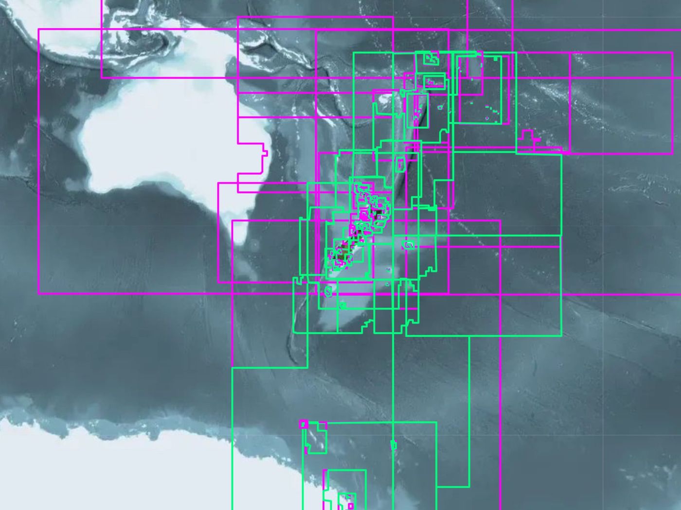
Raster Nautical Charts, or RNCs, are distributed as .kap files. Think of them as high-quality digital scans of the paper charts you would find at any chandlery. The symbols, colour schemes, and layout are identical to the printed version, which makes them immediately readable to anyone who has spent time with a paper chart. The trade-off is that the resolution is fixed. Zoom in past a certain point and you gain no additional detail, because the image contains only what was printed.
Electronic Navigational Charts, or ENCs, take a fundamentally different approach. Stored as .000 files, these are vector charts in which every depth contour, symbol, and coastline feature is held as individual data rather than a fixed image. You can zoom in without any loss of clarity, switch layers on and off depending on what information you need, and run advanced functions such as automatic route checking. ENCs have long been the standard in commercial ECDIS systems, and they are gaining popularity among recreational skippers running PC-based charting software. Both formats cover the full New Zealand coastline, including offshore islands such as the Chathams and our subantarctic territories.
Downloading the charts costs nothing. LINZ makes its entire catalogue freely available at charts.linz.govt.nz, where you can pull a single harbour chart for a specific trip or download the complete New Zealand dataset in one go. Files arrive as zipped downloads, which you extract to a folder on your computer or tablet before pointing your navigation software at that location.
Two software options suit most Kiwi users well. OpenCPN is free and open-source, runs across Windows, macOS, Linux, Android, and even Raspberry Pi, and handles both RNC and ENC files without fuss. It has built up a loyal following among New Zealand cruisers precisely because of that flexibility. TimeZero sits at the commercial end of the spectrum, offering route planning, weather routing, and integration with Furuno radar and sonar systems for those who want a more fully featured setup. Both will index your downloaded charts and display your vessel's position against them once a GPS source is connected.
Downloading charts is only the beginning. A chart's value depends entirely on how current it is, and LINZ addresses this through its Notices to Mariners service, which issues weekly corrections. These updates capture new hazards, buoy relocations, changes to dredged channels, and any other developments affecting New Zealand waters. For ENCs, your navigation software will often handle updates directly. For RNCs, you may need to return to LINZ and download a corrected version of the relevant chart. Treating chart updates as a routine part of your pre-trip preparation, particularly before longer passages or at the start of a cruising season, is a straightforward habit worth keeping.
Commercial chart products such as Navionics or C-Map are widely used by New Zealand boaties, and they offer genuine advantages: crowdsourced depth soundings, satellite overlays, route suggestions, and polished interfaces. They are useful tools, but they are not the official chart. That distinction is worth keeping in mind.
LINZ charts are compiled and authorised by the national hydrographer and updated on a defined schedule. A proprietary chart product may lag behind, depending on the provider's update cycle. One piece of advice that has stayed with many experienced skippers is to use commercial charts for everyday navigation while keeping official charts close by to confirm positions and check tricky passages. Running both side by side and cross-referencing between them is a sensible approach that costs very little extra effort.
The case for using official charts becomes clearest when you think about where New Zealand's nautical challenges actually lie. The rocky approaches to French Pass, the sand-shifting channels of Kaipara Harbour, and dozens of other demanding passages around our coast require accurate, up-to-date information. An outdated or incomplete chart can place you on the wrong side of a shoal before you have time to react. Every New Zealand boatie can access official, regularly updated charts at no cost, which is a genuine advantage, but only for those who actually use them.
Whether you are commissioning a new cruising yacht, running a charter operation, or simply heading out for a day after snapper, adding LINZ chart downloads and updates to your standard preparation is a straightforward step. These charts were not designed solely for large commercial vessels. They exist for everyone navigating New Zealand waters.