
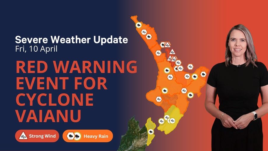
Tropical Cyclone Vaianu is tracking to pass just northeast of Northland late Saturday before swinging south across the North Island through Sunday. MetService has classified this as a multi-hazard, potentially life-threatening event, and the forecasts offer no room for complacency. Dangerous winds, heavy rainfall, and coastal inundation are all expected. For anyone with a vessel in northern or eastern waters, the window for reaching safe harbour is closing and the time to move is now.
Friday still offers workable conditions across much of the country, though the outer circulation of Vaianu is already making itself felt across the upper North Island. A high pressure ridge is keeping central New Zealand relatively settled, but conditions are changing rapidly further north. The Brett area is recording southeast winds around 20 knots, expected to climb to 30 knots by this evening as a northeast swell builds towards 4 metres. Kaipara is sitting at southeast 25 knots, with a rough sea developing and a northeast swell reaching 4 metres north of Cape Reinga. The Hauraki Gulf is seeing southeast winds of 15 knots, forecast to rise to 20 knots with gusts to 30 by late evening. Across most South Island areas the picture remains considerably calmer, with variable 10 to 15 knots and slight to moderate seas.
Saturday is when conditions turn severe. The Brett area and Colville are both under storm warnings, with southeast winds forecast to build to 50 knots by evening and a long-period easterly swell reaching 8 metres producing high seas. North of the Bay of Plenty, no vessel has any business being on the water. Kaipara carries a gale warning, with southeast winds expected to reach 35 knots and an easterly swell rising to 6 metres north of Cape Reinga.
The Bay of Islands is under a gale warning, with winds forecast to reach 45 knots and gusts to 55 knots by early evening, alongside an easterly swell climbing to 6 metres. The Hauraki Gulf is also on a gale warning, with southeast winds reaching 35 knots gusting 45 by late evening and a very rough sea developing. Both the Bream Head to Cape Colville zone and the Coromandel are under strong wind advisories set to escalate to gale warning conditions by evening, with swells to 4.5 metres.
Further east, the Plenty area carries a gale warning with easterly winds reaching 40 knots by evening and a northeast swell building to 6 metres offshore. Portland is also under a gale warning, with the roughest conditions expected north of East Cape. In the far south, Milford and Puysegur are on gale and storm warnings respectively, though these are driven by a front approaching Fiordland from the west rather than by Vaianu directly. The Waitemata Harbour has a strong wind advisory for Saturday, with southeast winds of 25 knots gusting 35 expected in the morning. Heavy swell warnings are current for the Wellington south coast, the Kapiti-Porirua coast, and the Wairarapa coast.
Sunday will bring the worst of the event. As Vaianu tracks south across the North Island, land-based severe weather warnings already include a red wind warning for the Coromandel Peninsula and Great Barrier Island, where gusts may reach 140 km/h. Orange wind warnings cover Northland, Auckland, Bay of Plenty, Gisborne, Hawke's Bay, Waikato, Taranaki, and Whanganui. Heavy rain warnings and watches span most of the North Island and extend into parts of the upper South Island. Marine conditions across all northern and eastern areas will be extreme, and no recreational or coastal boating should be attempted on Sunday.
The message for skippers is straightforward. Any vessel currently at sea or sitting in an exposed anchorage in the upper or eastern North Island should be heading for safe harbour right now. Waiting until Saturday will leave many ports impossible to enter safely. Once secured, skippers should check berth lines, stow and secure all loose gear, and monitor MetService continuously as the situation develops. A further forecast revision was due at 9pm Friday. Meaningful uncertainty remains in Vaianu's track, and warnings are likely to be upgraded as the cyclone closes in.