Cyclone Vaianu is closing in on the North Island, bringing damaging winds, heavy rain, and coastal inundation severe enough to trigger multiple States of Emergency across the country. The Waikato Civil Defence Emergency Management Group declared a State of Emergency at 9.32am on Saturday 11 April, covering the entire Waikato CDEM Group area and set to remain in force for seven days.
That declaration follows one made in Northland on Friday evening, with Whakatane and Hawke's Bay also operating under their own States of Emergency. The four declarations together reflect the scale of what authorities are calling one of the most significant weather events in recent years, requiring a coordinated national response.
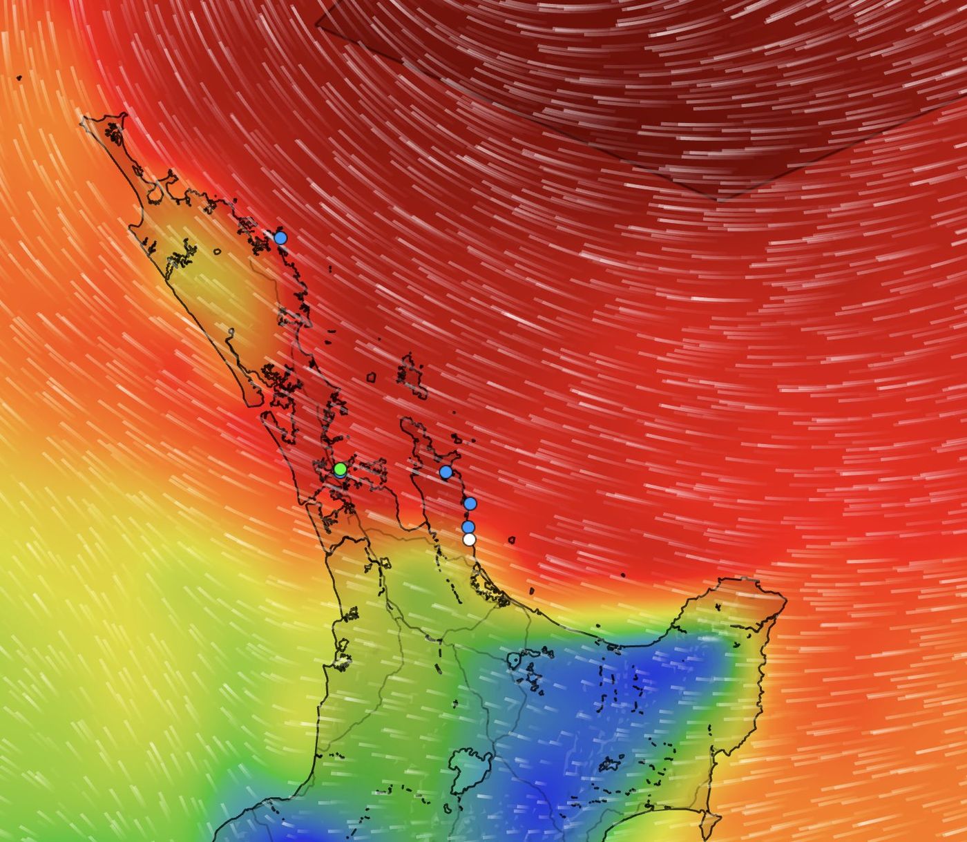
MetService issued an update at 2.40pm on Saturday confirming the strong wind warning for Bay of Plenty and Rotorua had been upgraded to Red, placing it alongside the Coromandel Peninsula and Great Barrier Island at the highest alert level. Gusts of up to 130km/h are forecast in exposed locations, with peak conditions expected through Sunday. MetService has characterised Cyclone Vaianu as a multi-hazard, potentially life-threatening event combining damaging winds, heavy rainfall, and coastal flooding across much of the North Island and the upper South Island.
Conditions are forecast to deteriorate from Saturday evening. The main impact window opens late Sunday morning and runs through to mid-afternoon, before easing progressively from the north.
Northland will bear the first sustained impact, with severe gales from 9pm Saturday through to 2pm Sunday and 60 to 90mm of rain expected, peaking at 20 to 30mm per hour. Auckland faces 80 to 110mm over a similar period, with heavy swells and coastal inundation likely around Great Barrier Island and the outer Hauraki Gulf. Gusts of up to 130km/h are forecast in exposed places, and forecasters have noted a moderate chance of the warning being upgraded to Red.
The Coromandel Peninsula and Hauraki are facing the most severe conditions anywhere in the country. A Red strong wind warning is in place from 10pm Saturday to 6pm Sunday, with severe gale easterlies shifting to severe gale northwesterlies and damaging gusts reaching 130km/h. Rainfall of 120 to 150mm is expected, especially about the ranges, at peak intensities of 25 to 40mm per hour. Large swells and coastal inundation are also anticipated.
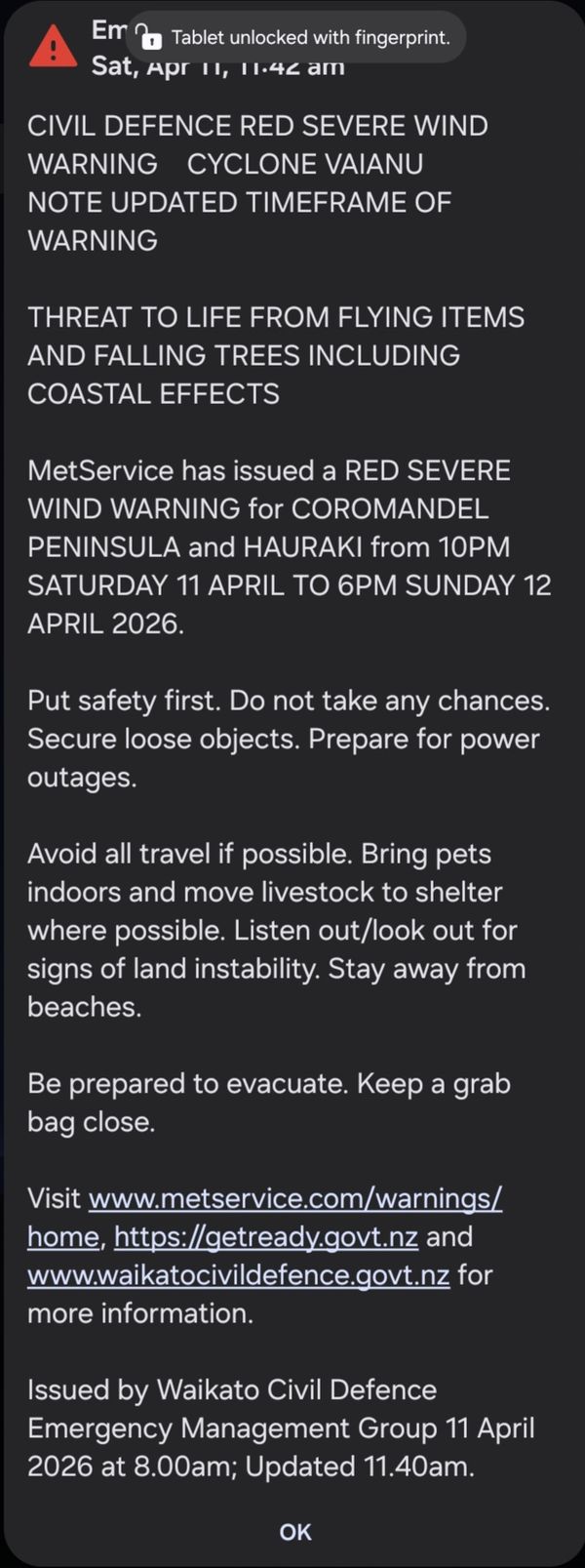
Bay of Plenty and Rotorua come under a Red warning from 4am to 8pm Sunday, facing the same severe gale conditions and the same threat to life from flying items and falling trees. Gisborne and Tairawhiti can expect 120 to 150mm of rain about the ranges, with large swells and coastal inundation likely along the coast. The Waikato, including Waitomo, Taupo and Taumarunui, faces a 20-hour strong wind warning beginning at 2am Sunday, with gusts up to 120km/h and heavy rain watches in place.
For the boating community, the marine forecast is extreme. MetService has issued storm warnings for the Colville, Plenty, Portland, Bay of Plenty, Coromandel and Hawke Bay areas, with gale warnings covering the Hauraki Gulf, Waitemata Harbour, Manukau Harbour, Bay of Islands, and numerous other coastal waters.
The Colville Channel, running between the Coromandel Peninsula and Great Barrier Island, is facing some of the most severe conditions in the country. Gusts of 65 knots are forecast, with northeast swells building to 8 metres. The Hauraki Gulf can expect southeast winds of 40 knots gusting to 60 knots on Saturday evening, shifting to westerly 45 knots gusting 60 knots through Sunday afternoon, with seas becoming high and visibility very poor in heavy rain. The Bay of Plenty faces northeast winds of 50 knots gusting to 65 knots Sunday morning, with swells rising to 6 metres under storm warning conditions. On the Wairarapa coast, heavy swell warnings have been issued, with combined waves forecast to reach 6 to 6.5 metres by Sunday afternoon, coinciding with high tide.
Cyclone Vaianu is expected to track southeast and pass west of the Chatham Islands on Monday, after which a series of fronts will continue to affect the country through Tuesday and Wednesday.
Waikato CDEM Group Controller Julian Snowball was direct in his message to residents. "If you are worried about your safety, particularly if you live in an area that has been impacted by flooding or land-slips, please do not wait. Contact your local council now to discuss alternative accommodation options."
Councillor Emma Pike, Waikato CDEM Group Joint Committee Chair, described the declaration as rare but necessary. "This is a serious weather system expected to affect the entire Waikato CDEM Group Area to varying degrees. Declaring a State of Emergency now allows us to act early, be as agile as possible, and proactively reduce the risk to our communities."
Meteorologists have drawn comparisons with Cyclone Cook in 2017, which followed a similar track down through the top of the North Island and along the East Coast.
Anyone with a vessel should move boats to shelter or haul them out of the water without delay. Stay well away from beaches, shorelines, and harbours. Secure all loose items on boats and around marina berths. Prepare for power outages by charging devices and assembling a grab bag. Once conditions begin to deteriorate, avoid all travel, never drive through floodwater, and be ready to evacuate if instructed.