
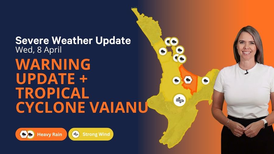
A slow-moving front has stalled over the northeast of the North Island, dragging a humid northeast flow with it and producing persistent, heavy rain across a broad area. For anyone with a boat in the water, conditions are already deteriorating.
An Orange Heavy Rain Warning remains active for Bay of Plenty west of Whakatane, including Rotorua, until 9pm tonight. A further 60 to 80mm is expected on top of what has already fallen, with intense bursts of 25 to 40mm per hour possible during the heaviest downpours. There is a small chance the warning could be escalated to Red before the system clears.
Heavy Rain Watches are in place for the Coromandel Peninsula, Waikato, Waitomo, Taumarunui, Taupo and eastern Bay of Plenty, extending through today and into Thursday. These sit one tier below a full warning but should not be taken lightly.
Conditions on the water across the upper North Island are already unpleasant. The Coromandel is experiencing northeast winds gusting to 35 knots alongside rough seas and very poor visibility in heavy rain. Bay of Plenty carries a Strong Wind Advisory, with northeast winds gusting to 35 knots and swells of 2.5 metres. A Gale Warning is in force for Castlepoint, where northeast winds are reaching 35 knots and seas are very rough. Puysegur is also under a Gale Warning today.
Rivers are expected to rise quickly across warned areas, with surface flooding, slips and dangerous road conditions all probable outcomes.
The bigger threat is what is tracking down from the tropics. Severe Tropical Cyclone Vaianu, a category three system, is currently sitting roughly 380km south-southwest of Nadi, Fiji, and heading south. Vaianu has already caused significant impact across Fiji and now has New Zealand firmly in its path.
MetService Meteorologist John Law flagged the seriousness early — issuing a Severe Weather Watch days ahead of when they'd normally do so. That early call is itself a signal of how significant this system could be.
Vaianu is forecast to lose its tropical characteristics on Friday, transitioning into an extra-tropical cyclone before continuing south-southwest toward New Zealand across the weekend. MetService assumes official forecasting responsibility for the system once it crosses 25°S, which is expected sometime Thursday morning.
A Strong Wind Watch has been placed over the entire North Island for Sunday 12 April, running from 1am through to 11pm. Should Vaianu follow its forecast track, winds could reach damaging and, in some locations, life-threatening levels, accompanied by heavy rain and hazardous coastal conditions across much of central and northern New Zealand.
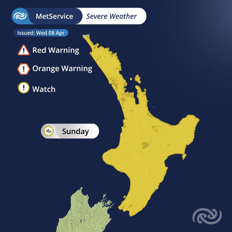
Portions of the Watch are expected to be upgraded to Orange Warnings, with the possibility of Red Warnings in some areas, as the storm's track becomes clearer over the next few days. Heavy Rain Watches and Warnings linked specifically to Vaianu are likely to be issued on Thursday.
Which locations bear the worst of the impact, including fallen trees, power outages, flooding, slips, road closures and isolated communities, will depend on exactly where Vaianu makes its approach. That picture will sharpen as the days pass.
Anyone planning time on the water this weekend should keep those plans on hold until the latest forecast has been checked. Saturday is already shaping up as a rough day across the north and east, with heavy rain and southeasterly gales expected to develop in Northland by Saturday evening.
Sunday is a different level entirely. Gale southeasterlies are forecast across most of the North Island, eventually swinging to gale southwesterlies as the system pushes through. Coastal waters will be hazardous. Stay ashore.
The northern and western South Island is also likely to take a significant hit, with heavy rain forecast and conditions expected to worsen throughout the day.
MetService will be issuing regular forecast updates as Vaianu draws closer. Check metservice.com frequently, download the MetService app and enable notifications for Severe Weather Warnings in your area. For guidance on preparation before the storm arrives, getready.govt.nz is the place to start.
Warnings and watches can shift rapidly as the situation evolves. Always check metservice.com before heading out on the water.